Ortho-Mosaic Mapping
 An Orthomosaic map is a detailed, accurate photo representation
of an area, created out of many photos that have been stitched
together and geometrically corrected (“orthorectified”).
An Orthomosaic map is a detailed, accurate photo representation
of an area, created out of many photos that have been stitched
together and geometrically corrected (“orthorectified”). It could be described as an ultra high definition Google Satellite map.
It records the ever-changing cultural and natural features on the Earth's surface.
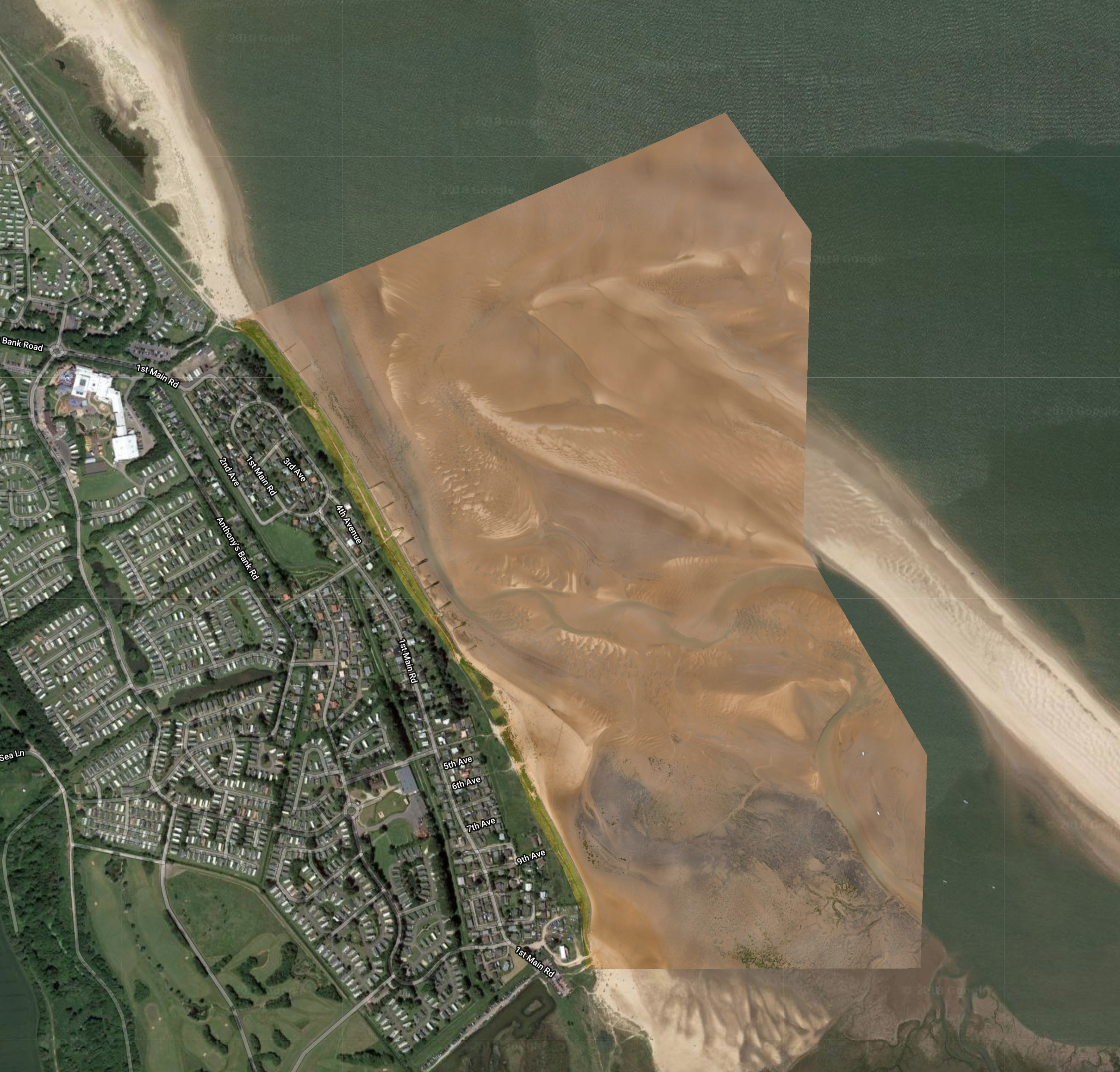
Photograph 1: Is an example of a repeat commission for a 206 acre environmental mitigation project to monitor coastal erosion over time. It consists of approx 1000 high definition photographs taken at 350ft.
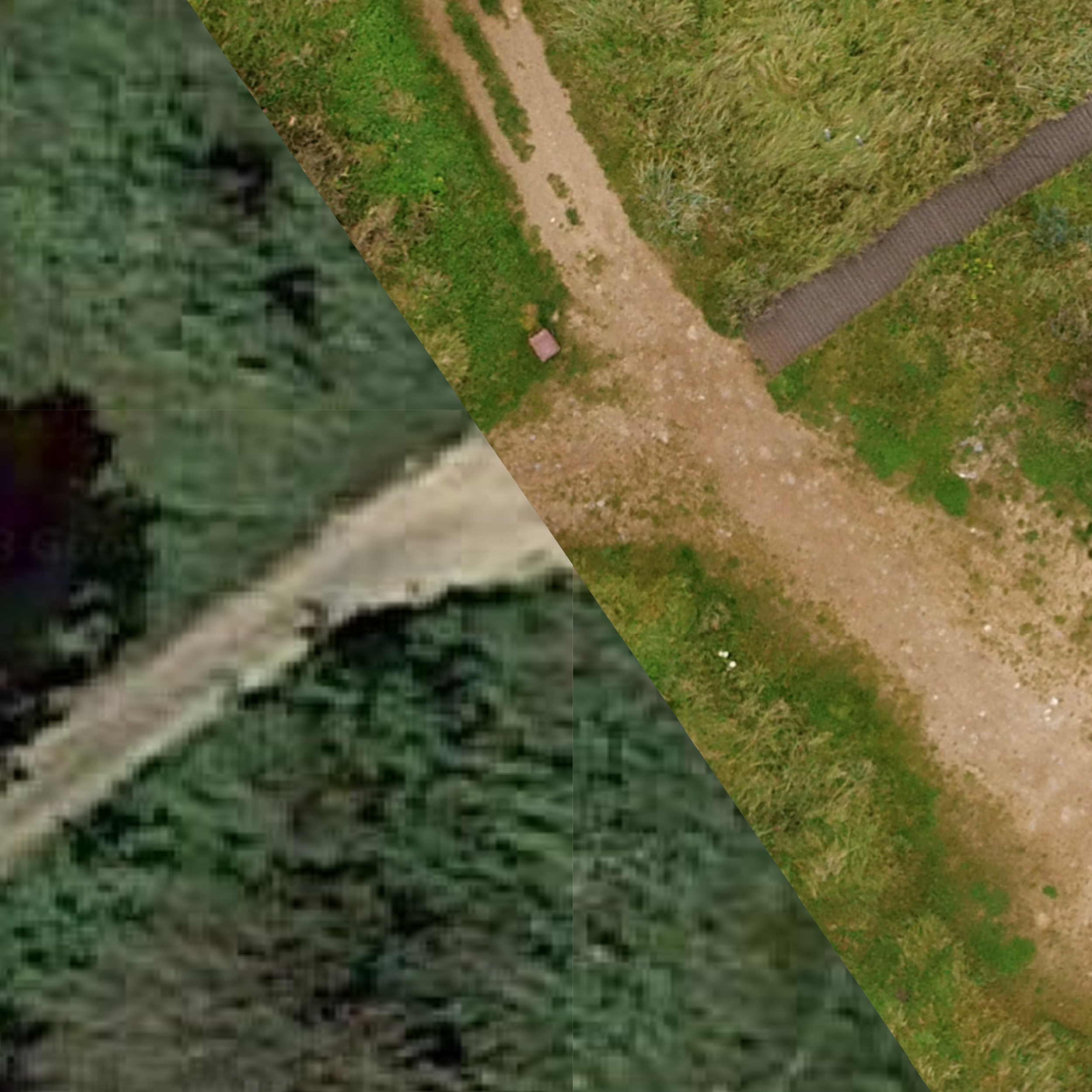
Photograph 2: This shows the difference in definition between Google Satellite map quality and a Ortho-Mosaic map quality
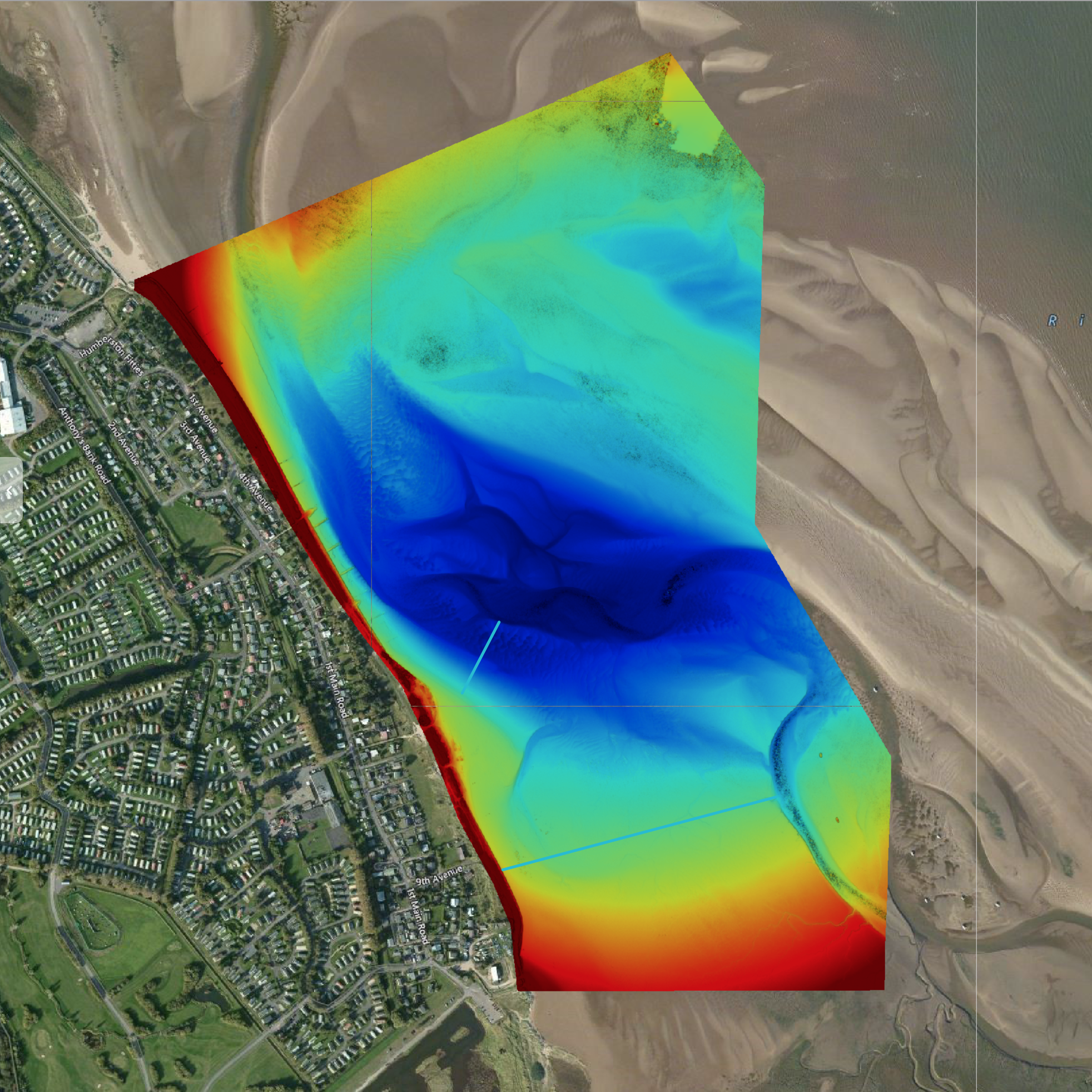
Photograph 3: This shows elevation model that can be created to view a visual representation of the deviation in terrain.
Other applications
Construction: Orthomosaic maps can help provide detailed updates on the progress of a construction project, since they allow you to zoom in and see different parts of the building(s) under construction, as well as related resources.
Real Estate: Orthomosaic maps are being used in real estate to provide detailed, interactive maps of properties, which help realtors in their efforts to sell them. An orthomosaic map made for real estate purposes could be of a small area, such as a house, or it could cover thousands of acres of property. Typically they’re used to showcase large properties or estates, since it can be difficult to show a prospective client the entire piece of land and/or details of the buildings on the property when they are so spread out.
Emergency Management:When disaster strikes, quick and accurate information is vital for emergency management to effectively respond, especially when the disaster covers a large area. Using drone photogrammetry, officials can determine the most damaged areas of a disaster (think flood or hurricane). With this data, they can effectively distribute their resources for a timely response.
Record Keeping: Orthomosaic maps are powerful visuals to have for record keeping. Using these maps helps property owners and insurers track changes in a property over time. Comparing orthomosaic maps allows people to visualize changes in the tree-line, patterns in how the property is used, and under-utilized space.